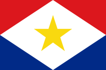
SABA
 In the past nicknamed “The Virgin Queen of the West Indies” or “The Island of Women”, Saba is an emerged part of an extinct volcano for 5000 years ago whose highest point is Scenery Mount (887m). Its area is 13 sq km. There is no river. The middle of the island is mountainous and covered with vegetation. The west side is dry while the east side is more green. In Saba grow rare wild orchids and several flowers among them the hibiscus.
About 60 species of bird are counted like swallows, sternes (Sterna Fuscata), hummingbirds, frigates birds, falcons with red tail. There are also small lizards (Anolis Sabanus) and harmless snakes…
During many years, Saba fought to overcome its isolation due to its hilly relief and built an airport in 1959, a main road and a pontoon.
Tourism which is the major branch of industry in Saba, started to increase from the 1980s. Agriculture is also present with productions of patatoes, taros and lettuce etc. Fishing (fish and lobster) is a traditional economic activity.
The first inhabitants of the island were Ciboneyes arrived in 1175 BC. Towards 800 AD, the Arawaks immigrated to the Caribbean and built villages in Saba.
Some archeological excavations carried out in the region of Spring Bay (north-east) proved the presence of Arawak Indians in the island, 1300 years ago. In 1923, an important Amerindian village was also discovered in Saba.
Christopher Columbus sighted Saba on November 13th, 1493, during his second voyage to the New World. In 1632, the first European colonists – some shipbuilders – tried to settle down on the island. The Dutch people from the Dutch West Indian Company appropriated the island, in 1640. This colony came from Sint Eustatius (or Statia) and settled in Middle Island and Mary’s Point where there are still vestiges (tanks, walls etc.). Shortly afterwards, it was chased away by the British pirate, Henri Morgan. During almost 200 years, Saba changed nationality (Dutch, Spanish, French or English). At that time was founded the village of The Bottom which is, today, the administrative centre and the capital of Saba.
Because of its very hilly topography, it was impossible to set up in Saba some large plantations so, slavery stayed limited.
For years, the island was transformed into a den for the pirates in the Caribbean Sea. Their descendants (the Dutch, the Scots, the Irish, the Africans and the English people) became sailors and fishermen. The men were often absent, the women get used to being independent by making shoes, socks, belts etc. Then, Saba was also nicknamed “The Island of the women”.
After it was a member of the Netherlands Antilles, Saba voted for being directly run by the kingdom of the Netherlands ; it is a “special municipality” like the islands of Sint Eustatius and Bonaire. In 2011, Queen Beatrix of the Netherlands visited the island of Saba.
Saba is divided into four villages : The Bottom, the capital ; Windwordside ; St John ; Hell’s Gate.
Area : 13 sq km (5 sq miles)
Population : 1 990 inhabitants
Capital : The Bottom
Languages : Dutch (official) – English
Currency : Netherlands Antillean Guilder (NAf)
People : Sabans
