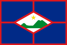
ST EUSTATIUS
 St Eustatius (in Dutch) or St Anastasia is 31 sq km. Cliffs surround almost the whole island, there are only three beaches. A large part of its territory is very dry, there is no river. In the coast grow small scrubs, various tropical plants and flowers (pink laurel, bougainvilleas…). In the north, there are several mountains : Signal Hill (234m), Little Mountain (200m) and Boven (294m). The Quill (from “Kwil” which means volcano in Dutch) looks down on the south of the island. It is an extinct volcano whose highest point is Mazinga (600m) ; its crater is occupied by a humid forest with tall trees, ferns, banana trees…
The wildlife is comprised of iguanas, lizards, snakes, donkeys… Some species of bird nest in the island.
Tourism, fishing and oil stockage for neighbouring islands are the main economic activities of the island nicknamed, today, Statia.
There are three phases of colonization in Sint Eustatius : the first group of individuals who came from the Orinoco Basin (Venezuela) arrived on the island in 500 BC and lived near Corre Corre Bay ; the second group – the Saloïdes – colonized the island from 300 to 700 AD ; the third group – the Caribs – occupied this land from 1000 AD. Some ceramics and stone tools from this era can be admired in Sint Eustatius Museum. In 1923, was discovered the place of Golden Rock that dated back to the 5th century AD ; it is considered as St Eustatius’ largest Amerindian village.
The Carib Indians called this land “Alo” that means “Mahogany”. Christopher Columbus named it Santa Anastasia when he discovered it, in 1493. The French colonists started to build there a fort, in 1629. In 1636, the Dutch colonists settled in St Anastasia after they expeled the French settlers. During the following years, Santa Anastasia also was the subject of rivalry between the European nations (England, France, the Netherlands).The island changed owner twenty-two times.
In the 18th century, St Anastasia became a duty-free island. The French and British who lived in the West Indies and North America sent their goods via St Anastasia to not pay many taxes in their colonies. Quickly, St Anastasia with its 20 000 inhabitants of various nationalities became a trade centre between Europe and America.
During the 1770s, the island was called “The Golden Rock” : more than 300 ships dropped anchor in its harbour. During the American Revolution, African slaves, arms and munitions conveyed in transit by St Anastasia thanks to the Dutch merchants but the English disliked that… Great Britain got so angry when, on November 16th, 1776, St Anastasia fired a 13-gun salute to the war ship Andrew Doria which belonged to the American rebels. By this action, St Anastasia was the first foreign land that recognized the independence of American colonies. In reprisals, in 1781, the British admiral George Rodney seized the island, destroyed all the warehouses, expeled the Dutch merchants and sold by auction their properties.
Few years later, The Netherlands appropriated again St Eustatius but the colony did not regain its former prosperity any more.
Since 1954, Statia was a town of The Netherlands Antilles as St Maarten, Saba, Bonaire and Curaçao. After the dissolution of this Federation, on October 10th, 2010, St Eustatius (as Bonaire and Saba) chose to be directly run by The Netherlands. The island is a “special town” of the kingdom : the local daily affairs are handled by a Council that is elected locally and presided over by a lieutenant-governor ; the Dutch government is in charge of Foreign Affairs.
Area : 31 sq km (12 sq miles)
Population : 4 000 inhabitants (2012)
Capital : Oranjestad
Languages : Dutch (official) – English
Currency : Netherlands Antillean Guilder (NAf)
People : St Eustatians