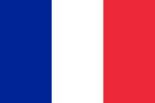
ST MARTIN
 It is the world’s smallest territory shared between two countries : France and The Netherlands.
St Martin’s area is 52 sq km ; St Maarten represents 34 sq km. The island’s topography is diverse. It is composed of coasts, plains ans small valleys, in the centre. The highest point – Pic Paradis (Paradise Peak 424m) – is located in the French part. In the west of the island, there are some strips of land which surround the Simpson Bay Lagoon. This pond is one of the vastest in the Caribbean.
The vegetation of St Martin/St Maarten is rather dry with palm trees, flamboyants, hibiscus, bougainvilleas, cacti…
The species of bird are various : hummingbird, sea gull, heron, frigate, egret etc. The lizards abound.
The island has a duty-free status so trade is an important activity. However, from the 1950s, tourism first started to develop in the Dutch part and now it constitutes the main economic sector in St Martin / Sint Maarten. The whole population of the island was 15 000 inhabitants until the 1980s, now it is almost 70 000 because of an importante immigration.
Christopher Columbus discovered the island on December 11, 1493 during his second voyage and named it St Martin after the bishop St Martin of Tours. As for the Carib Indians who had already chased out the Arawak Indians, they called this land “Soualouiga” (Land of Salt) because of its numerous salt marshes.
In 1631, some colonists arrived in the island. The French settled in Orleans while the Dutch occupied Little Bay. The Spanish who regarded St Martin/St Maarten as their property seized it. The hundred of inhabitants was exiled. In 1644, the Dutch led by the explorer Peter Stuyvesant did not succeed in recapturing the island. The Spanish had reinforced the building of the fort that the Dutch had begun… During this attack, Stuyvesant lost its leg because of a cannonball. In 1648, Spain left St Martin/St Maarten. In the same year, French and Dutch colonists settled again in the island. They signed an agreement to share between themselves this land but it was not always respected.
During 32 years – to 1670 from 1702 – the French occupied the whole island. The Dutch invaded St Martin/St Maarten in 1703 and tried to chase out the French. The two nations continued fighting in spite of the signature of the Treaty of Utrecht, on April 11, 1713.
To 1784 from 1794 then to 1810 from 1816, the English colonized the island. In 1817, the present frontier was drawn. According to the vox populi, the boundary was determined following a running between a French and a Dutch.
During all these years of colonization, many slaves who came from Africa developed the plantations of sugar cane, tabacco, cotton, coffee and indigo. Salt was collected from 1840 to 1962.
The Abolition of slavery, in 1848, in French territory and in 1863 in Dutch territory ruined the plantations.
During the Second World War, the Allied were present in St Martin/St Maarten. The Americans built there a military airfields that became the Juliana Airport, located in the Duch part.
Since October 10, 2010, Sint Maarten is an independent island within the kingdom of the Netherlands. Before, it was a town of the Netherlands Antilles with Saba, St Eustatius, Bonaire and Curaçao. The latter was the island-capital.
St Martin was a commune of Guadeloupe. On December 7, 2003, there was a referendum on the island and on July 15, 2007, St Martin became a “French Overseas collectivity” with a status more autonomous. It is led by an elected president and en elected assembly. It is represented in the French Parliament in Paris. A prefect represents France in the island. St Martin’s inhabitants are French citizens.
Area : 52 sq km (20 sq miles))
Population : 35 000 inhabitants
Capital : Marigot
Languages : French (official) – English patois – Creole – English
Currency : Euro ($)
People : Saint Martiners
