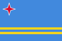
ARUBA
 Aruba belongs to the Lesser Antilles and is situated at almost 25 km from Venezuela. Its area is 193 sq km, it is the smallest ABCs (Aruba, Bonaire and Curaçao). In the north are settled the capital – Oranjestad – and almost all the hotels along the beaches. The vegetation is green. The island is flat, its highest point is the Mount Jamanota (188m). In the east is located the Arikok National Wildlife Park. This arid area with rugged shores, sand, dunes, caves, abandoned gold mines represents 20% of the island. Two gardens – Cunucu Arikok and Shon Shoco – present numerous traditional medecine plants. In the park grow different varieties of cactus, aloe plant, the kwihi tree, the hubada tree, the divi-divi tree and an important mangrove.
Morever, several animals live in the island : reptiles (iguanas…), fishes (barracudas, rays, sharks…), birds (parrots…). There is no river in Aruba.
The economy of the island developed, in 1924, with in particular the construction of an oil refinery in San Nicolas, in the southwestern end of the territory. The unemployment appeared in the 1950s because of the automation in the sector. From 1985, the Dutch government turned resolutely to tourism which was not very developed at that time, when the refinery closed down. Even if the oil refining started again in 1990, tourism continued its expansion.
The Caiquetios Indians who belonged to the Arawaks tribe and came from South America were Aruba’s first inhabitants. Some tools which were found during excavations showed that, 4000 years BC, Humans lived there.
During the Pre-ceramic era (2500 BC – 1000 AD), they depended on the sea to live by being fishermen-hunters-gathers. They inhabited on the coasts of the island which are today places called Malmok and Palm Beach.
At the beginning of the Ceramic era (1000-1515 AD), these Amerindians built five big villages on the best fertile lands to produce corn and manioc. Their deceaseds were buried according to different ways relative to a hierarchical and sociopolitical system. They were also very talented in pottery.
The Spanish conquistador Alonso de Ojeda discovered this small island in 1499, he claimed it for the Spanish crown and named it “The island of the Giants” but the Spanish people did not really colonize it because of the drought. In 1513, all the Amerindian population in Aruba was enslaved and sent to the island of Hispaniola, today shared between Haiti and the Dominican Republic. During the Spanish colonization, some of them had the opportunity to return to their island whereas others Amerindians arrived from South America. This population lived peacefully on the island until the Dutch settlers with their African slaves arrived in 1636.
In the 18th century, a fort was built in Oranjestad – Fort Zoutman – to protect themselves against the pirates but the island did not interest them because it had no mining resources.
At the beginning of the 19th century, the Indians represented a third of the 1700 inhabitants but some historians think that the last Amerindian really born in Aruba, died in 1862.
During the same century, the English tried to appropriate the island but their domination did not last.
In 1986, Aruba withdrew from the Federation of the Dutch West Indies and became an autonomous territory within the Netherlands kingdom.
Area : 193 sq km (74,5 sq miles)
Population : 112 000 inhabitants
Capital : Oranjestad
Languages : Dutch – Papiamentu
Currency : Aruban Florins (AFl)
People : Arubans
